Can You Track a Stolen Trail Camera? GPS, Cellular and Photo Clues
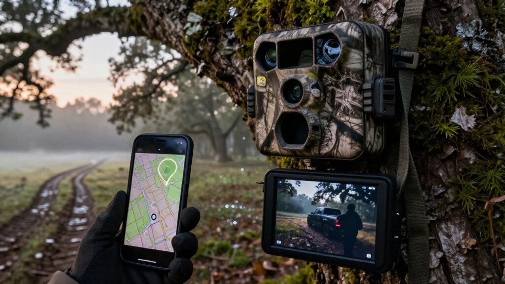
You can sometimes track a stolen trail camera, but it isn’t a live tracker. Check the app for its last cellular ping, timestamp, battery level, signal strength, and GPS-enabled check-in; these show the last documented area, not necessarily its current location.
Preserve uploaded photos, videos, geotags, and metadata for removal clues. Record the IMEI and serial number, then share timestamped evidence with police, the manufacturer, and carrier.
Next, learn how each clue limits your search.
Last Cellular Ping Evidence
Start with the camera’s last cellular ping: the most recent successful transmission establishes the best immediate record of where it was operating before it went offline. Check the app for coordinates and the associated timestamp, then compare that time with its normal reporting schedule. You can treat this point as a documented last-known area, not proof of the camera’s exact location when it disappeared.
Many units refresh their map position only after a successful connection, so displayed coordinates may be current only through that transmission. Review final uploaded photos for GPS geotags, visible landmarks, weather, light conditions, or nearby vehicles that narrow the search area. Also assess power and coverage: a dead battery, scheduled check-in interval, or network delay can create a gap between movement and the final ping.
IMEI-Based Camera Identification
Beyond the last cellular ping, record the camera’s IMEI, the unique cellular-device identifier that distinguishes your unit from every other camera of the same model. Find it in the setup or admin screen, on original packaging, or in registration records, then preserve it with your purchase documentation. If you registered the camera before theft, compare the IMEI against the device listed in the manufacturer’s app or cloud account. That match establishes which physical unit generated account activity and communications.
Give the IMEI to the camera manufacturer and cellular carrier when reporting the theft; they may use it for account-association checks, technical troubleshooting, or documented law-enforcement requests. Include it in your police report. It doesn’t provide location; that still requires cellular transmission and GPS updates.
Photos Captured During Camera Removal
Review the last images and videos uploaded before the camera went offline, because a thief may trigger the unit while removing or handling it. Examine timestamps, species-recognition labels, and scene details for human-triggered frames or abrupt activity changes. Compare each upload time with the camera’s daily or programmed cellular check-in schedule; a scheduled transmission may send recent removal photos after the unit is gone.
If geotagging was active, inspect the photo or video information bar for coordinates recorded near the suspected removal time. These points can narrow the location and establish a timeline. Some apps show camera movement only after another communication, so infer removal from the nearest frame’s timestamp and any subsequent map-position jump. Preserve originals, metadata, screenshots, and upload records promptly.
GPS-Enabled Trail Camera Models
Choose a built-in GPS cellular trail camera that geotags captures and reports its position after a successful check-in. You can use movement alerts and updated map coordinates to document when a thief relocates the unit.
Compare cellular capability, app-based GPS support, and reporting intervals; models such as the Tactacam Defend Security Camera Cellular and Stealth Cam Deceptor Max 3.0 Cellular support these functions.
Built-In GPS Trail Cameras
Built-in GPS cellular trail cameras add a practical recovery lead by reporting their approximate map position to the mobile app after the next successful cellular transmission. GPS receivers typically use signals from four or more satellites to calculate position through trilateration; accuracy generally improves when more satellites are available.
You can register the camera’s original location and examine movement alerts as potential theft evidence, remembering that the alert appears only when the unit next communicates. Location metadata may also place northing/easting coordinates in each photo’s or video’s information bar.
Compare those coordinates against terrain features to test whether images document animal movement or intrusion. Cloud delivery of location-tagged files lets you preserve a record for later review, so you don’t need onsite SD retrieval.
Cellular GPS Tracking Options
Cellular GPS-enabled trail cameras give you the strongest post-theft tracking option because the companion app can update the camera’s approximate map location whenever it successfully transmits a photo, video, or scheduled check-in. If a thief moves the unit, its next successful cellular contact can refresh displayed coordinates and may trigger a location-change alert. Treat that timestamp as confirmed evidence of movement, not necessarily theft time.
Media information carries GPS geotags, including coordinate fields, helping you document where camera communicated. For recovery, prioritize app-based GPS reporting; signal-based estimates are less precise when GPS is unavailable. Where supported, two-way cellular controls let you request an image or alter settings remotely, preserving investigative access without retrieval. They consume power and data, so requests can shorten battery life.
Model Features Worth Comparing
Often, the best GPS-enabled trail camera for theft recovery is the one that produces the strongest evidence after it next contacts the network. Compare models for app-based photo and video geotags, which let you map the last reported location; GPS updates only when the camera transmits, not instantly. Confirm that GPS is consistently available for map viewing and that a movement-triggered anti-theft alert is supported.
Check imaging specifications: HD capability, such as differences between Spartan GoCam 2 M and Spartan GoLive 3 M, can preserve faces, vehicle details, and landmarks. If you need verification, prioritize two-way communication for on-demand photos or live view, while accounting for battery drain.
Finally, examine daily or programmable check-ins. Reliable scheduled transmissions create a location timeline for recovery.
Battery Level and Signal
Check the camera’s last reported battery level, signal bars, and mapped location to establish its final confirmed status. A low battery or weak cellular signal can prevent the next scheduled check-in, leaving the app with an outdated location. Treat an offline status as a transmission problem first, not proof that GPS has failed.
Last Reported Battery Level
Start with the last battery percentage and signal reading in the camera’s app, as these status reports establish whether it likely remained capable of transmitting after it disappeared. Record the timestamp beside that reading, then treat it as an operational cutoff, not proof of the theft time. High charge supports a longer transmission opportunity; low charge can explain why alerts stopped soon afterward.
| App evidence | Investigative meaning |
|---|---|
| High battery | Camera may have remained powered |
| Low battery | Updates may have ended quickly |
Compare the final percentage with prior battery drain under similar settings. If it was low and signal was weak, define a narrower capture window. Remember that scheduled communication can delay status reporting, so the displayed reading may predate the camera’s final attempt to transmit.
Signal Strength and Location
Use the final battery and signal readings to assess how reliable the app’s last mapped location is. A strong reported signal and adequate battery support a more recent position, because the camera can complete uploads with fewer retries. Weak signal, by contrast, can delay the next successful cellular communication and consume more power, so a map marker may trail the camera by hours or days.
If GPS reception is poor, the system may estimate position from nearby cell towers; that signal-based result is generally less precise than GPS. Treat low battery plus weak signal as evidence that the displayed location may be stale. For future recovery, configure check-ins or on-demand updates within your power budget; stronger connectivity improves update speed and location accuracy materially.
Interpreting Offline Status
An “offline” label usually shows that the camera hasn’t completed a recent cellular communication, not that it has necessarily stopped recording or been moved. You can check battery percentage and last successful sync before assuming a theft; review its last confirmed transmission time. Critically low power can halt transmissions, while recordings may remain stored locally.
| Evidence | What you infer | Why it matters |
|---|---|---|
| Critical battery | Transmission may stop | Preserve doubt |
| Weak signal | Sync windows missed | Map stays stale |
| Normal battery | Investigate removal | Time matters |
Models report at scheduled check-ins, so app status can lag. Compare timestamps, battery history, and signal readings. A map pin isn’t proof; GPS position updates only after connection. Document changes; wait for the next sync window before treating offline as removal.
When your cellular trail camera reports after a theft, preserve and share each original timestamped photo or video with police, along with the app’s map location for that transmission. Original files retain embedded date, time, and GPS metadata, while screenshots may remove information investigators need.
Use the information bar to document northing/easting coordinates and export or reference the map location associated with each transmission. These records let officers compare when the camera moved with where it reported, narrowing activity windows and linking images to possible routes or suspects. If your model supports on-demand requests or live view, submit any newly received original media promptly. Record the app account name, camera identifier, and download time in your report. Keep unaltered copies and note each file’s source.
No Signal, No Location Updates
No signal means your cellular trail camera can’t deliver GPS coordinates, map positions, or movement alerts to its app. Poor coverage, a dead battery, a disabled SIM, or a carrier outage prevents the transmission needed to update the map. Many models report location only during a successful scheduled check-in or trigger-based upload, so the last displayed position may remain unchanged until service returns.
GPS may still calculate coordinates, but indoor placement or heavy tree cover can reduce accuracy. More importantly, without a cellular connection, the camera usually can’t send those coordinates to your app or cloud account. Anti-theft moved alerts can also depend on periodic uploads.
Check the camera’s power status, SIM activation, carrier coverage, and last transmission time; frequent commands drain batteries faster.
Cellular Cameras Aren’t Live Trackers
Cellular trail cameras don’t provide continuous, real-time tracking: they typically transmit a photo, status report, or GPS position only after a motion trigger or scheduled check-in. That means a thief’s movement won’t appear on your map until the camera reaches its next successful transmission window.
- GPS coordinates refresh only when the device sends data.
- On-demand photo requests need app access and usable cellular service.
- Near-live viewing still suffers network and upload delay.
- Theft alerts can arrive after the next scheduled check-in.
- Frequent transmissions improve responsiveness but drain batteries faster.
When you assess evidence, compare each alert timestamp with the configured reporting interval. A last known point establishes when the camera communicated, not where it traveled afterward or who moved it. Treat delays as expected.
Document the Camera’s Serial Number
Record the camera’s unique serial number before deployment, then store it separately from the device. Find it on a label inside the battery compartment or on the unit’s back. Log the number with the model name, installation date, and purchase evidence, such as a receipt or order ID.
If theft occurs, provide this identifier to police, the manufacturer, your app provider, and cellular carrier. They can compare it with your account and service history, which helps verify ownership and may support re-association of a cellular camera. Preserve the original setup location shown in the app, if available, alongside those records.
This evidence won’t create live tracking, but it establishes a precise chain of identification during recovery inquiries. Keep copies offline; avoid sharing them publicly.
Conclusion
If someone steals your trail camera, you can still build an evidence trail, but you can’t treat it as a live GPS tracker. Preserve the last cellular ping, timestamps, battery and signal data, transmitted photos, model details, serial number, and IMEI. Don’t alter account records or confront suspects. Give police original files and a timeline. GPS-capable models may add location evidence; cameras without service won’t provide continuing updates. Your documentation strengthens identification, recovery, and prosecution.